My friend and I decided that Labor Day would be the perfect day to tackle the 14.8 mile round trip hike to see the Kolob Arch in Zion National Park. We had recently found out that tucked in the back country wilderness of Zion was the world's 2nd longest natural arch, measuring 287.4 feet.
We met at a gas station on the NE outskirts of Las Vegas at 4:50 am to carpool to the trail head. We took I-15 North to Utah and turned off at exit 40. The Kolob Visitor Center is just off the highway. We arrived at 7:50 am and it opened at 8:00 am so we had a few minutes to wait before we could go inside. Once inside, we showed our park pass, grabbed a park map and asked a few questions about the trail. Then we were off.
The trail head parking lot was a few miles from the Visitor Center. We parked, grabbed our gear, asked a ranger to take our picture and then walked the 100 yards to the actual trail head. The sun wasn't over the mountains yet so it was a little chilly but not too bad. We had seen rain and lightening on the drive to Utah so we were worried about rain but it stayed clear for the entire day.
The first few miles of the trail were downhill. The trail was nicely maintained with wooden steps in several areas. I brought my hiking poles with me but didn't feel like I needed them at any point along the way.
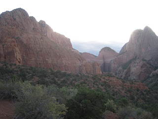
As we neared the valley floor, the sun began to peak over the mountains. It was beautiful!
Once on the valley floor, we began to walk through deep sand. It made it a little difficult to walk. We began to hear water and shortly we were hiking along the La Verkin Creek. It was small but clear. The sound of rushing water was such a beautiful sound. This portion of the hike was pretty exposed so it began to get warm.
On our way to the turnoff, we passed campsites 1-10. The first three were higher up but 4-10 were along the creek and would be my choice in campsites. I don't remember seeing campsite 10 but the map showed that it was right by the turnoff.
Just when we were wondering if we had somehow missed our turn, we saw the sign directing us to the Kolob Arch. It said that we were 0.5 miles from the arch. Once we turned, we began to walk along a small creek bed. This required a small amount of scrambling but not too much. If the water was higher, it would have been more difficult.
Finally, we could see the arch. There was a sign saying that we were at the end of the trail and to not go beyond that point. The arch was high above us along the cliff wall.
After lunch, we made our way back along the creek bed to the main trail. The sun was high and it was warm. We had come prepared and had plenty of water. There was no clean water along the trail so if you needed drinking water, you would have to filter the creek water before drinking it.
We made our way back through the sand and along the La Verkin Creek again. The several miles of sand hiking made our legs sorer than normal. We were almost happy to see the trail begin the ascent because that meant we would be on solid trail again.
The final climb was steep but not too bad. The hike details had said to expect to take 10-12 hours to completed the hike. We were able to finish in about 7 hours. We were both very happy to see the end of the trail and our car.
We loaded up the car and decided to drive to the end of the scenic road to see the overlook. It provided an amazing panoramic view of the area that we had just hiked through.
It was a fantastic day and a hike I'd recommend. It wasn't the most spectacular thing I've ever seen but the fact that it was something that so few people actually see, made this a very special hike.


No comments:
Post a Comment